Features
Part of Ferry travel planning: sort every item into four columns
Free stops that fill the gaps in a longer ferry itinerary
Named free stops on real ferry routes, from Nauset Marsh to the Astoria Riverwalk, fill the waiting hours around a sailing with small walks.
What to take away
- Every stop below is free, and each sits within walking distance of a ferry terminal or a short ride from one.
- Estuaries and salt marshes are the most reliable free stops, because they do not close for weather or season.
- A free stop on the departure side is what saves the day when a sailing is canceled.
- Flat boardwalk and rail-trail walking suits mixed groups better than anything you pay for.
- Check the site's own hours before you commit a connection to it.
Why free stops carry the itinerary
A ferry trip has fixed expensive parts and long flexible gaps. The gaps are where budgets are lost, because an unplanned gap gets filled with whatever is nearest and priced accordingly.
Filling those gaps deliberately with free stops lowers the total and gives you somewhere to be when the boat is delayed. A stop within walking distance of the terminal beats a better one an hour away.
Estuaries: the most reliable free stop on any coast
Estuaries sit where ferry terminals do, not by coincidence. NOAA calls estuaries bodies of water usually found where rivers meet the sea, with plant and animal communities adapted to brackish water.
Freshwater versions exist too. Along the Great Lakes, river water mixes with lake water in coastal wetlands shaped by tides and storms. They filter runoff and nurse many birds and fish.
For a visitor that means birds, changing water, and usually a path. An estuary walk works in most weather, needs no booking, and rewards a second visit at a different water level.
Salt marshes: flat walking, big skies
A salt marsh is the estuary's quieter neighbor. NOAA describes salt marshes as coastal wetlands flooded and drained by salt water brought in by the tides, on soils of deep mud and peat.
Frequent flooding and decomposing plant matter drive oxygen in the peat very low, a condition called hypoxia. The bacteria involved produce the sulfurous smell people associate with marshes. That smell is normal, not pollution, and the boardwalks exist because the ground will not take a footpath.
Named free stops by route
| Stop | Where it is | Why it earns the walk |
|---|---|---|
| Nauset Marsh Trail | Salt Pond Visitor Center, Cape Cod National Seashore, near the Hyannis and Provincetown sailings | A one-mile loop over marsh and pond; free, open year-round |
| Sachuest Point National Wildlife Refuge | Middletown, Rhode Island, a short ride from the Newport and Block Island terminals | Free refuge trails on a salt pond; good winter waterfowl |
| Liberty State Park | Jersey City, beside the Battery and Liberty Landing ferries | Free waterfront paths with the Statue of Liberty across the water |
| Governors Island | A five-minute ferry from Lower Manhattan; the island itself charges no admission | Car-free paths, hammocks and the Hills, all free once you land |
| Astoria Riverwalk | Along the Astoria, Oregon waterfront, near the riverfront trolley line | A paved rail-trail under the Astoria-Megler Bridge |
| Grand Isle State Park | Grand Isle, Vermont, near the Lake Champlain ferries | Free day-use shoreline on the lake, with the crossing in view |
| Fort Worden Historical State Park | Port Townsend, Washington, beside the Coupeville ferry | Bluff trails, bunkers and a free beach day-use area |
| Sandy Hook | Gateway National Recreation Area, near the Highlands and Atlantic Highlands ferries | Free ocean and bay beaches, plus the old lighthouse grounds |
Two more that cost nothing but a look: the public fishing piers at Point Judith, Rhode Island and at Fort Adams in Newport. Both are free to walk, and both put you beside working boats.
Where they fit in the day
Put one free stop before the outbound sailing. Put another on the far side, within walking distance of the landing. Put a third on the departure side as your cancellation fallback.
That third stop matters most. It turns a lost sailing into a different day, the cheapest insurance. Our weekend cost breakdown shows how much that changes the total.
Common questions
Are these sites accessible?
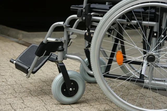
Boardwalks are common and often level, but surfaces and parking vary by site. Check the specific park's page, and ask the operator about boarding assistance under its published ADA policy.
Is there a best time of day?
Low water for mud flats and birds, high water for reflections and boat movement. Both are worth doing once, and neither needs a reservation.
Do I need binoculars?
They help enormously and cost nothing to carry. A cheap pair beats none, especially on a refuge trail in winter.
How do these fit a longer itinerary?
As the connective tissue between crossings. Our budgeting guide for ferry travel covers how free days change the arithmetic, and our photographer's field list covers what to carry for the light at each one.